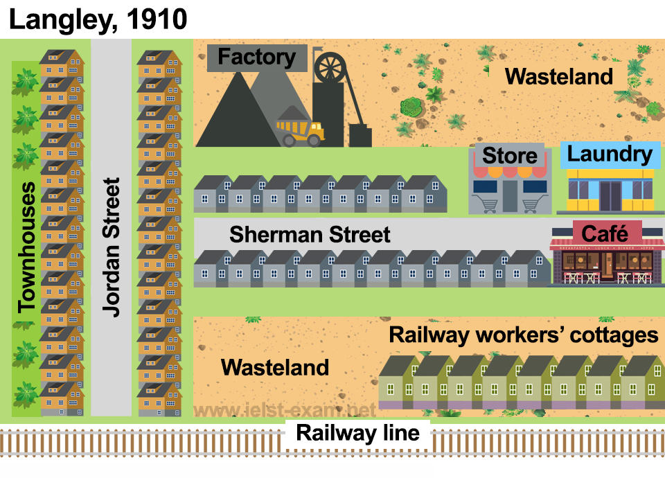
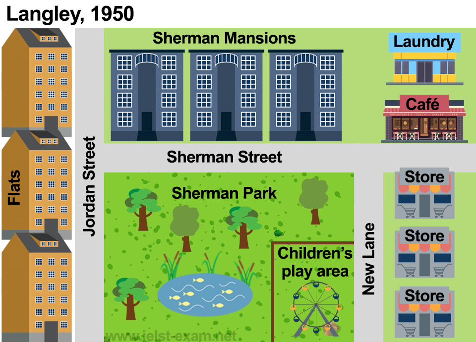
The two maps show the town of Langley in the years 1910 and 1950 and the urban developments that took place. Over this 40-year period, there were a number of notable changes to the buildings and amenities of this area.
In 1910, the area had a combination of residential and industrial features, but by 1950 the industrial features had largely disappeared. For instance, in 1910 a railway line ran through the neighbourhood, but by 1950 this had been removed. In addition, the townhouses which used to dominate the 1910 map had been replaced by blocks of flats, and the areas of wasteland had been redeveloped.
A key transformation in 1950 was the development of more commercial and recreational facilities. The demolition of a second row of houses on Sherman Street and the removal of the railway line made room for a spacious park and children’s play area. Moreover, to the right of the park, new stores were constructed on the aptly named New Lane, replacing the small store of 1910, while the café and laundry were relocated.
Overall, the area underwent extensive renovation, with fundamental changes to its residential accommodation and the addition of improved commercial and recreational amenities.